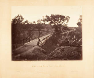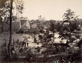
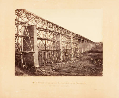

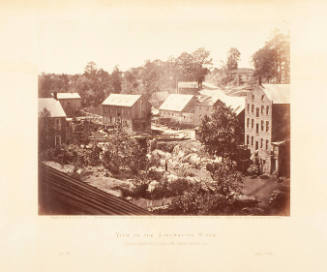
High Bridge Crossing, The Appomattox, near Farmville on South Side Railroad, VA
Artist
Timothy H. O'Sullivan
(American, 1840-1882)
Publisher
Philp and Solomons, Washington, D.C.
(American)
CultureAmerican
Date1865
MediumAlbumen print
DimensionsOverall, Image: 6 3/4 x 8 7/8 in. (17.1 x 22.5 cm)
Overall, Support: 12 x 15 1/2 in. (30.5 x 39.4 cm)
Overall, Support: 12 x 15 1/2 in. (30.5 x 39.4 cm)
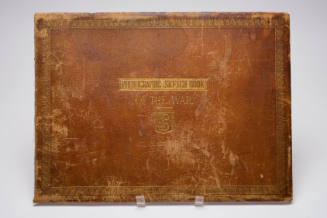
PortfolioGardner’s Photographic Sketch Book of the War
Credit LineMuseum purchase and partial gift of Carol L. Kaufman and Stephen C. Lampl, in memory of their parents Helen and Carl Lampl
Object number91.23.98
Not on view
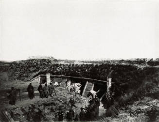
DescriptionThis is an albumen print from GARDNER'S PHOTOGRAPHIC SKETCH BOOK OF THE WAR, Vol. 2.Label Textright Timothy O’Sullivan American, 1840–1882 High Bridge Crossing, The Appomattox, near Farmville on South Side Railroad, VA, 1865 From Gardner’s Photographic Sketch Book of the War, published by Philp & Solomons, Washington, D.C., 1866 Albumen print (photograph) Museum purchase and partial gift of Carol L. Kaufman and Stephen C. Lampl, in memory of their parents Helen and Carl Lampl 91.23.98 War’s human toll is all too familiar, but war also has a striking impact on the land. The image on the right depicts High Bridge, which spans the Appomattox near Farmville, Virginia. Prized as the second tallest bridge in America in the mid-1850s, the bridge was nearly destroyed by Confederate soldiers fleeing Union troops. Despite the damage, Union soldiers crossed the river and continued their pursuit to Appomattox, where General Robert E. Lee surrendered to Ulysses S. Grant, ending the war. The photograph on the left depicts the Dutch Gap Canal, a waterway dug by Union forces to bypass Confederate forts near Richmond. Facing regular attacks from Confederate soldiers, 120 men, including many freed African Americans, removed 15,000 cubic yards of soil and rock. When explosives blew out the central dam to connect the canal’s two halves, however, it failed to breach the gap, leaving the canal unusable until after the war. Exhibition History"An Enduring Interest: The Photographs of Alexander Gardner", The Chrysler Museum, October 20, 1991-January 5, 1992. "New Light on Land: Photographs from the Chrysler Collection," Chrysler Museum of Art, Norfolk, VA, January 28 - May 15, 2016.Published ReferencesGARDNER'S PHOTOGRAPHIC SKETCH BOOK OF THE WAR, Vol. 2 (Washington, DC: Philp and Solomons, 1866).

Timothy H. O'Sullivan
April 1865