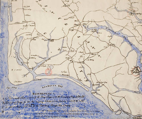

Princess Anne County during the Revolution
CultureAmerican
Date1956
MediumPhotostat
DimensionsOverall: 17 3/8 x 17 in. (44.1 x 43.2 cm)
Overall, Frame: 20 x 24 in. (50.8 x 61 cm)
Overall, Frame: 20 x 24 in. (50.8 x 61 cm)
Credit LineGift of Mr. C.W. Grandy
Object number45.13.1
Not on view
DescriptionPhotostat of a map of Princess Anne County, Virginia, prepared during the Revolution by English Army Engineers for the use of said Army while under the command of Benedict Arnold, the Traitor, while he was in command at Portsmouth in 1781. New photostat, though folded into quarters. Folded over at top for about 6 inches. Water colored blue and various points circled in red for Yorktown Jamestown de Grasse celebration, Sept. 28, 1956.


National Aeronautics and Space Administration (NASA)
1967