Skip to main content
Collections
Favorites
Advanced Search
Expand
Favorite
View PDF
Map
Previous
Next
New photography by Shannon Ruff captured with a digital camera-2008.
Map
Date
No Date
Medium
Print on paper
Object number
0.4122
Not on view
Description
Map of the Chesapeake Bay showing Cape Charles.
Discover More
Position of the English and French Fleets Immediately Previous to the Action on the 5th Sept. 1781
1794
Map
No Date
Map
No Date
Map
1865
Map
No Date
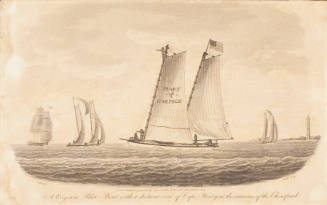
A Virginia Pilot Boat with a Distant View of Cape Henry at the Mouth of the Chesapeake
No Date
Print
No Date
Converse
No Date
Sketches at Indian Lakes
No Date
Print
No Date
Print
No Date
Print
No Date