Skip to main content
Collections
Favorites
Advanced Search
Expand
Favorite
View PDF
Map
Previous
Next
New photography by Shannon Ruff captured with a digital camera-2008.
Map
Date
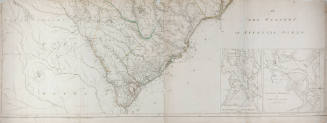
1865
Medium
Print on paper
Object number
0.4119
Not on view
Description
US Coast Guard Survey map of North Carolina
Discover More
Henry Mouzon
An Accurate Map of North and South Carolina with their Indian Frontiers
May 30, 1775
Henry Mouzon
An Accurate Map of North and South Carolina with their Indian Frontiers
May 30, 1775
Map
No Date
Map
No Date
Map
No Date
Map
No Date
Fry & Jefferson
A Map of the Most Inhabited Part of Virginia Containing the Whole Province of Maryland with Part of Pennsylvania, New Jersey & North Carolina
1751
A. Schoepf
Trigonometrical survey of the North Harbor
1853
A. Schoepf
Trigonometrical survey of the North Harbor
1853
Fry & Jefferson
A Map of the Most Inhabited Part of Virginia Containing the Whole Provinence of Maryland with Part of Pennsylvania, New Jersey & North Carolina
1751
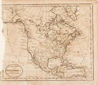
A New Map of North America Showing all the New Discoveries
19th century?
Print
No Date