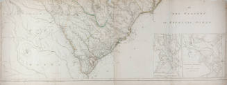
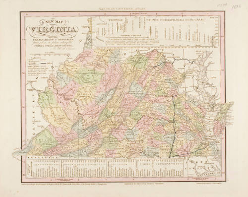
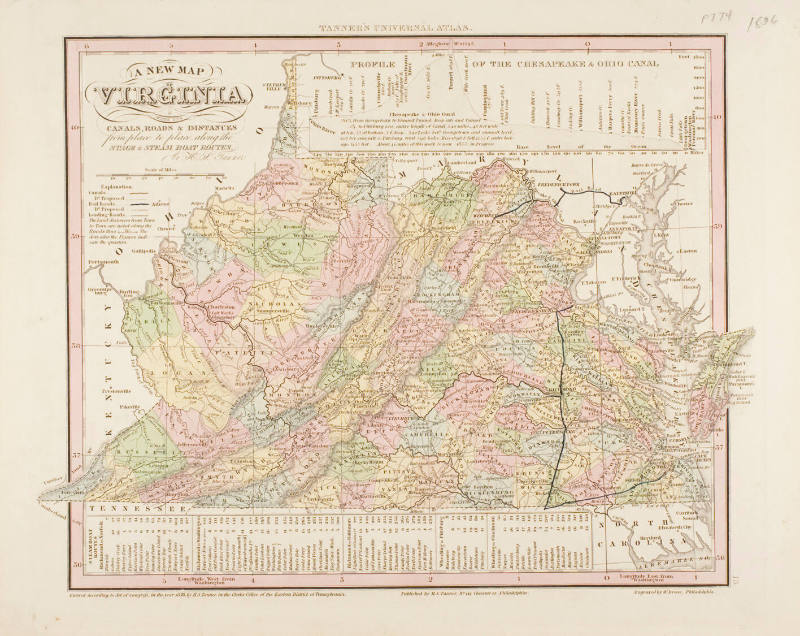
A New Map of Virginia with its Canals, Roads and Distances
Artist
W. Brose
Publisher
H. S. Tanner
CultureAmerican
Date1836
MediumEngraving,paper
DimensionsOverall: 13 x 10 13/16 in. (33 x 27.4 cm)
Overall, Frame: 16 x 22 in. (40.6 x 55.9 cm)
Overall, Frame: 16 x 22 in. (40.6 x 55.9 cm)
InscribedTitle and "Published by H.S. Tanner, No 144 Chestnut St. Philadelphia/Engraved by W. Brose, Philadelphia". From Tanners Universal Atlas "P 774 1836" written in pencil in upper right margin. "13" engraved in right margin at lower right corner of map.
Credit LineThe Chrysler Museum, Norfolk, VA
Object number51.37.16
Not on view
DescriptionEngraved and tinted map of Virgina. Entered according to Act of Congress by H.S. Tanner, in the Clerk's Office of the Eastern District of Pennsylvania.Published ReferencesTANNERS UNIVERSAL ATLAS, (H.S. Tanner: Philadelphia, 1836), p. 774.