Skip to main content
Collections
Favorites
Advanced Search
Expand
Favorite
View PDF
Untitled
Previous
Next
New photography by Shannon Ruff captured with a digital camera-2008.
Untitled
Culture
American
Date
1802
Credit Line
Museum collection
Object number
0.5531
Not on view
Description
Photograph enlargement of a map. Street map of Norfolk.
Discover More
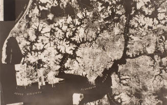
Photo of Mosaic Map of Norfolk & Vicinity
ca. 1918
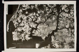
Photo of Mosaic Map of Norfolk & Vicinity
ca. 1918
Architect's Design for the New Monroe Building
ca. 1915
Unknown
Map of Talbot Park
ca. 1942
John White
First Map of Virginia
ca. 1592
Samuel W. Bowman
Norfolk, Va. and Vicinity
1891
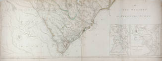
Henry Mouzon
An Accurate Map of North and South Carolina with their Indian Frontiers
May 30, 1775
Henry Mouzon
An Accurate Map of North and South Carolina with their Indian Frontiers
May 30, 1775
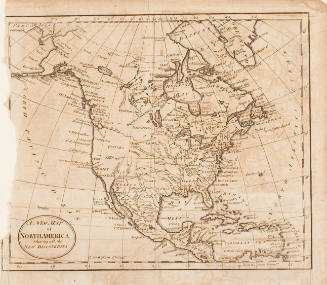
A New Map of North America Showing all the New Discoveries
19th century?
J.H. Colton & Co.
Virginia
1855
North America from Brown's book
ca. 1770
Norfolk and Portsmouth Virginia 1873
1873