

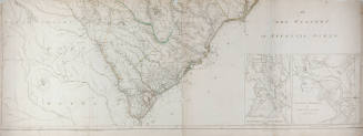
Map of Talbot Park
Manufacturer
Unknown
CultureAmerican
Dateca. 1942
MediumPaper
DimensionsOverall: 12 1/8 x 8 in. (30.7 x 20.3 cm)
Overall, Frame: 19 1/4 x 14 1/4 in. (48.9 x 36.2 cm)
Overall, Frame: 19 1/4 x 14 1/4 in. (48.9 x 36.2 cm)
Credit LineGift of Mrs. William F. Egelhoff
Object number54.40.80
On View
Not on view


Préfecture de Police de Paris, Service de l'Identité Judiciaire
January 1910
Préfecture de Police de Paris, Service de l'Identité Judiciaire
July 1910