Skip to main content
Collections
Favorites
Advanced Search
Expand
Favorite
View PDF
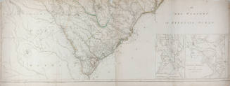
Map of Hampton Roads
Previous
Next
New photography by Shannon Ruff captured with a digital camera-2007.
Map of Hampton Roads
Culture
American
Date
No Date
Medium
Paper
Credit Line
Museum collection
Object number
0.348
Not on view
Description
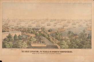
Map of Hampton Roads.
Discover More
C. Bohn
The Great Expedition - The Vessels At Anchor At Hampton Roads, From The Top Of The Hygeia Hotel, Old Point Comfort, Va.
1861
Samuel W. Bowman
International Naval Rendezvous, Hampton Roads, VA, April and May 1893
1893
Charles A. Morrisette
Bird's Eye View Hampton Roads Area
1924
Plan des Environs de Williamsburg, York, Hampton et Portsmouth
No Date
Charles Worret
The Naval Engagement Between the Merrimac and the Monitor at Hampton Roads on the 9th of March 1862
1862
Henry Mouzon
An Accurate Map of North and South Carolina with their Indian Frontiers
May 30, 1775
Henry Mouzon
An Accurate Map of North and South Carolina with their Indian Frontiers
May 30, 1775
W. Brose
A New Map of Virginia with its Canals, Roads and Distances
1836
Pamphlet
1953
G. Mathiot
Electrotype Coast Chart No. 31, Chesapeake Bay, Sheet No. 1
1863
Charles Parsons
The First Naval Conflict Between Iron Clad Vessels. In Hampton Roads, March 9Th 1862.
1862
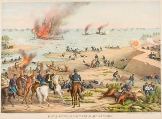
Kurz and Allison
Battle Between the Monitor and the Merrimac
1889