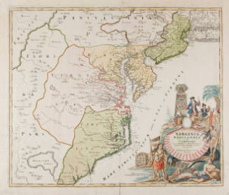

A Map of the Most Inhabited Part of Virginia Containing the Whole Province of Maryland with Part of Pennsylvania, New Jersey & North Carolina
Artist
Fry & Jefferson
CultureAmerican
Date1751
MediumEngraving
DimensionsOverall: 15 1/8 x 48 13/16 in. (38.4 x 124 cm)
Overall, Frame: 21 9/16 x 50 in. (54.8 x 127 cm)
Overall, Frame: 21 9/16 x 50 in. (54.8 x 127 cm)
InscribedLower right: "To the Right Honourable George Dunk Early of Halifax First Lourd Commissioner and to the Rest of the Right Honourable and Honourable Commissioners for Trade and Plantations. This Map is most humply Inscribed to their Lordships, By their Lordships Most Obedient & most devoted humble Serv. Tho. Jefferys."
"21" in upper right back corner of top and "22" in upper right corner of bottom. Top sheet watermarked "WF" twice and a cartouche with a fleur de lis/over a "GR" twice (once upsidedown). Bottom sheet has same watermark but both cartouches are right side up.
Credit LineThe Chrysler Museum, Norfolk, VA
Object number55.11.3B
Not on view
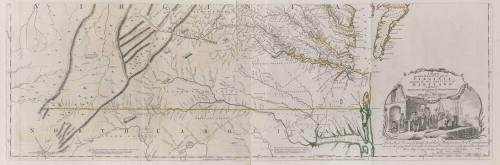
DescriptionPart of a map of the Virginia area, showing Virginia and some of North Carolina.Label TextJoshua Fry & Peter Jefferson A Map of the Most Inhabited Part of Virginia Containing the Whole Province of Maryland with Part of Pennsylvania, New Jersey & North Carolina Engraving, 1751 Collection Chrysler Museum of Art 55.11.3b This is the bottom half of an unassembled map showing the southern half of Virginia. Norfolk appears on this map and the cartouche at the right is probably intended to show tobacco being shipped from Norfolk.


1865