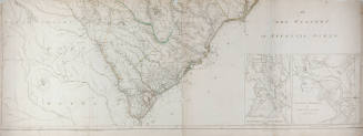


Virginie Maryland en 2 Feuilles
CultureAmerican | French
Date1777
MediumEngraving on laid paper
DimensionsOverall: 27 3/8 x 39 13/16 in. (69.6 x 101.1 cm)
Overall, Frame: 30 1/8 x 41 5/8 in. (76.6 x 105.7 cm)
Overall, Frame: 30 1/8 x 41 5/8 in. (76.6 x 105.7 cm)
InscribedTitle and "par Fry et Jefferson Traduit, Corrige, augmente/a Paris Chez Le Rogue Jng? Geographie du Roi/Rue des Grands Augustins/1777/Avec Privilege du Roi". "La Ligne entre la Virginie et la Caroline Septentrionale depuis Peters Criq jusqu'a Steep Rock Crique eant de 90 Miles 280 perches a ete measure en 1749 par Churton et Welson de la Caroline en 1728 Irvine et Mayn Arpenteurs/Virginie". "L'avoient trace depuis la Mer jusqu'a Peters Criq accompagnes des Commissaires Byrd, Dandridge et Fitzwilliams". An inset of S.W. Va. at lower right.
Credit LineThe Chrysler Museum, Norfolk, VA
Object number55.35.4
Not on view
DescriptionMap of Virginia and Maryland. Rivers and boundaries are tinted green, yellow and pink. Said by vendor to be "First Issue Rare". Portsmouth is not shown on map. Jamestown is not shown as an island but as a town. Upper right corner withing platemark "Planche 2e". An unrelated platemark showing in upper margin at left.